Nam Phong National Park
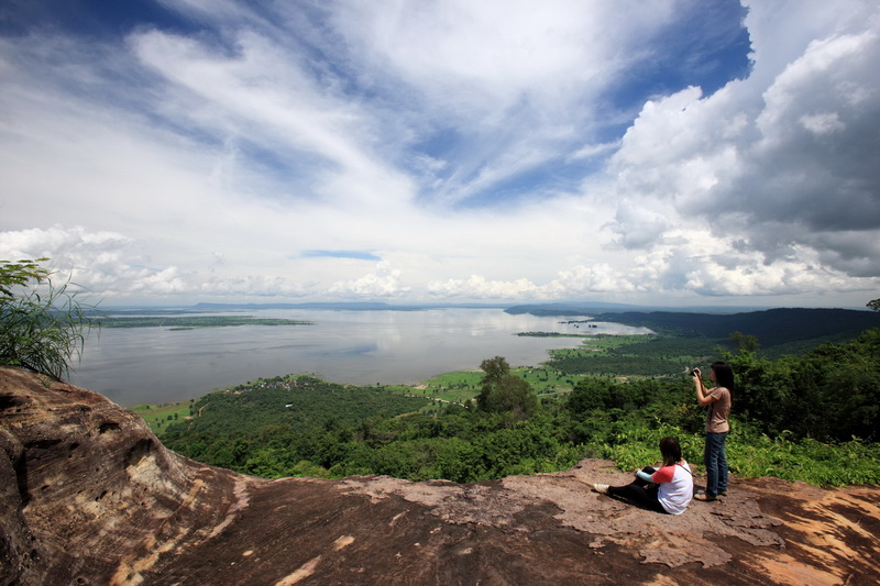
Total area of 197 square kilometers, Nam Phong national park covers 6 Amphoes in Khon Kaen; Nong Ruea, Ubolratana, Phu Wiang, Bang Fang, Mancha Khiri and Khok Pho Chai and another 2 Amphoes in Chaiyaphum include Ban Thaen and Kaeng Khro where the main headquarter is located by the lake over Ubolratana Dam. This National Park is located in the watershed of Chi and Phong Rivers where the deciduous dipterocarp and dry evergreen are the major herbal source in this mountain range. The main viewpoint of the park is Hin Chang Si which is the group of rocks where the wild elephants use for scrating their flanks. This point has a scenic view of the Uboltatana Lake and Khon Kaen City which can be accessed by car, 8 kilometers from Sok tae Reforestation Park. From the headquarter, walking to Hin Chang Si takes around 2 hours and another 30 minutes on foot from Hin Chang Si is Plan Caht viewpoint. Pha Sawan is another viewpoint where visitors can witness beautiful scenery of the lake which takes two-hour walk from the headquarters. Another interesting attraction in the park is Phon Kham, crater-like rock well. Opening hours: Daily from 6.00-18.00 Contact: Nam Phong National Park 043-248-006 or National Park, Wildlife and Plant Conservation Department (Bangkok) 02-562-0760. Admission fee is 100 bath for adults and 50 bath for children.Getting there: Nam Phong National Park can be reached from two routes; 1. From Khon Kaen, take Highway 12 to Chum Phae District then turn right at kilometer 30 to Ban Phue for another 19 kilometers on Highway 3034 (Nong Saeng-Tha Ruea). This route takes 49 kilometers in total.From Khon Kaen, take Highway 2 and head to Udon Thani before turn left to Amphoe Ubolratana then take Highway 3034 which lies along the lake over Ubolratana Dam. This route takes 65 kilometers in total. http://www.tourismthailand.org/See-and-Do/Sights-and-Attractions-Detail/Nam-Phong-National-Park–3469