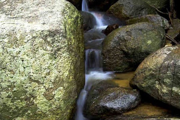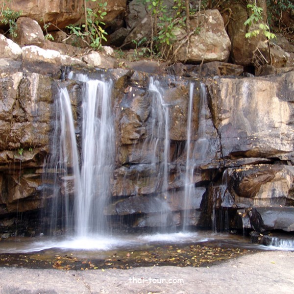
Namtok Pha Iang
Situated 3 km. from the Highway 2159 (Chaiyaphum-Nongbuadaeng) at Ban Chi Long Nuea, on the west of Tat Ton National Park, Amphoe Mueang Chaiyaphum province, Pha Iang Waterfall is a medium-size waterfall stemming from the Chi Long Stream. It is a cliff leaning towards the stream making the water run to one side. You can reach the waterfall by walking about 800 m. The waterfall is surrounded by the dry evergreen forest with numerous perennial plants creating a tranquil atmosphere which is ideal for relaxation. Near the waterfall are Pha Nit Waterfall, 500 m. far from the Pha Iang Waterfall and Pha Song Chan Waterfall which requires 1,200 m. walk. These waterfalls have a plenty of water in the rainy season and the water will dry out in the dry season. At this waterfall, the water runs all year round since the area around it is an unspoiled dry evergreen forest. Generally, the waterfall will be crowded on Saturdays to Sundays. Tat Ton National Park is a highland which covers the 1/4 area of Phu Laen Kha Mountain. In the area of the National Park are Phu Kiaw mountain, Phu Klang and Phu Laen Kha mountain which is the highest mountain with a height of 905 m. from the mean sea level and its peak is 945 m. high from the mean sea level. It is also the origin of Tat Ton Waterfall and other important rivers such as Huay Lam Pa Taw or Huay Tat Ton, Huay Nam Sap, Huay Khro, Huay Tat Ton Noi, Huay Si Nuan and Huay Kaen Thaw. These river also join and create a new river called “Huay Pa Thaw” passing the Chaiyaphum town. Moreover, there are other important rivers such as Huay Chi Long, Huay Cho Raka, Huay Siaw, Huay Khaen and Huay Siao Noi. The area around these rivers are dry-evergreenforest. The area by the river and the top of the mountain is quite fertile, but thedry dipterocarp forest in this area is not so fertile. For the accommodation reservation, please contact Tat Ton National Park Office at 579-0529, 579-4842