Phu Pha Thoep National Park
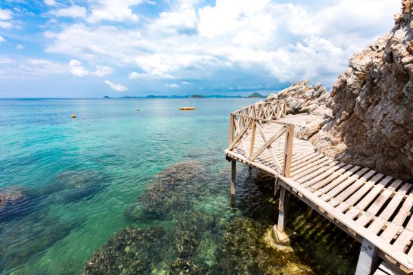
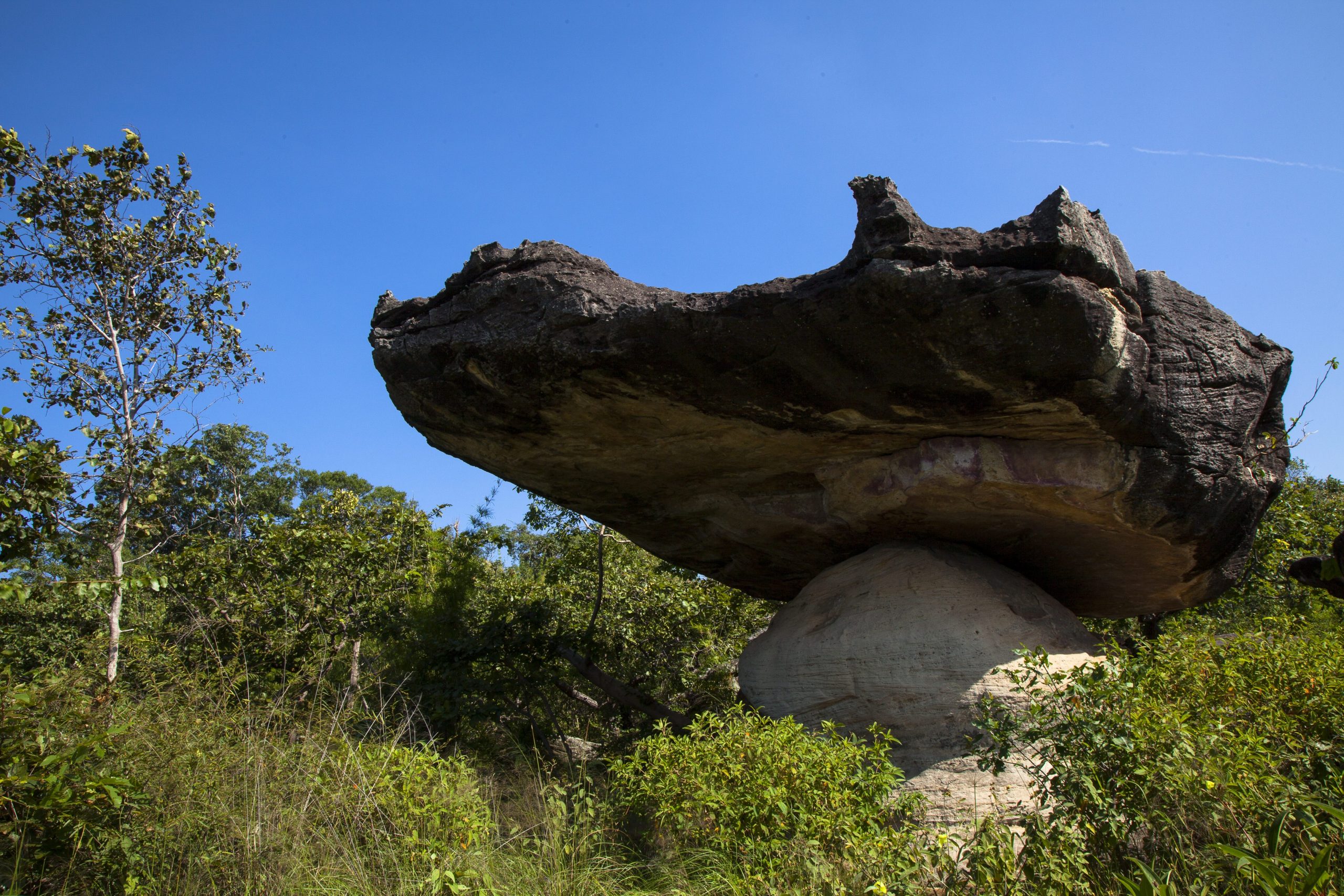
It is the 59th national park in Thailand. Its area is 48.5 square kilometers, or 30,312.5 Rai, covering the areas in Mueang Mukdahan District and Don Tan District. It is a sandstone mountain with large and small mountain ranges lying continuously like waves. It is situated at the end of Phu Phan mountain ranges. These ranges lie vertically and parallel with the bank of the Ganges River, making around 4-kilometer distance between the river and the ranges. Phu Pha Thoep National Park consists of Phu Mak Yang, Phu Mano, Phu Prong, Phu Rang, Phu Chom Nang, Phu Makmi, Phu Pha Thoep, Phu Nang Hong, Phu Tham Phra, Phu Lak Se, and the highest peak of Phu Chom Si, which is approximately 170- 240 meters high at the sea level. Most of the forests are dipterocarp forest and mixed forest. This mountain is also a source of many brooks such as Huai Ta Lueak, Huai Sing, Huai Ruea, Huai Ma-le, Huai Chang Chon, etc. At the foothill, there are bamboo forests grown line after line. Many areas are cliffs and wide rock terraces, with a lot of strange-looking stone. Some interesting tourist attractions in Phu Pha Thoep National Park are listed below.Hin Thoep Rocks. The formation of Hin Thoep Rocks, from the past up to present, is the origin of natural sculpture which is eroded by rain, water, wind, and sun. 95- 120 million years later, these rocks have been transformed to different shapes similar to jet planes, flying saucers, Chinese patterned small houses, crowns, crocodile heads, and conches. The layers of the rock vary in their durability because of different formation of sands. The durable sandstones in the upper layer are brown and comprise of Silica and a lot of gravels; whereas, those in the lower layer which have less durability are white with a lot of carbonate component. The geologic condition of Hin Thoep Rocks consists of sedimentary rocks in Sao Khua formation and Phu Phan formation in Khorat group. Their geologic structural model is in Mesozoic era which comprises of mud rocks, sandstones, siltstones, and conglomerates which are around 200-meter thick.Lan Mutchalin. It is a wide smooth rock terrace next to Hin Thoep Rocks, surrounded by dwarf deciduous dipterocarp forest which can be a form of combining natural beauty together. There are also bushes like Khoi Hin, Nang Fah Jam Laeng, Aon Lueang, and Kradon Dan. The uniqueness of this place which cannot be overlooked is the community of tiny plants, such as Soi Suwanna, Yat Nam Khang, Nao Duean Ha, Dao Ruam Duang, and Dusita. They blossom during October to December every year. From the middle of this terrace, the tourists can also see the view of the Ganges River. Wang Duean Ha Waterfall is a small waterfall which flows through Lan Mutchalin. There are ponds that help absorb water to nourish plants and wild animals around there. Inside the waterfall, there are rock basin, rock valley, and large rocks. A number of tourists usually visit this place and admire the scenery.Pha Ud. At this cliff, there is a stone sculpture with the shape like camel in the dessert. It is a spectacular viewpoint where the tourists can see Phu Tham Phra, Pha Phak Wan, and Pha Khee Mu very clearly. Beneath Pha Ud are widespread valleys surrounded with green forests.Phu Tham Phra. Legend has it that, in ancient times, the Khmer villages were situated at this place before Khmer people emigrated from natural disaster. They kept the Buddha images, which Khmer people worshipped, inside this cave. Many of these Buddha images were made of silver, copper alloy, gold, jade, plant called Wan, and wood. At present, the valuable Buddha images are lost, leaving only wooden Buddha images. There is also a beautiful waterfall called “Phu Tham Phra Waterfall.”Pha Manao. It is a smooth steep cliff with waterfall from the top of the cliff to the area below. The water nourishes forest resources and wild animals and make them abundant. At the top of the cliff, the tourists can see the wide scenery of Hin Thoep Rocks and the Ganges River. Below the cliff, the tourists can witness the beauty of waterfall, forest, and wild animal. The cliff “Pha Manao” is named after a number of lemon trees (Manao) grown in this area.Tham Fa Mue Daeng. Inside the cave are pre-historical color paintings which the archeologists assume to be more than 5,000 years old. This place is located in Phu Pha Thoep National Park Protection Unit 1 (Huai Sing) which is approximately 8 kilometers from the national park office.In addition, Phu Pha Thoep National Park has many other tourist attractions which are Pha Ngoi and Pha Puchao. The high season to visit this national park is during rainy season from May to September, during winter from October to February, and during summer from March to May.Admission fee is 200 bath for adults and 100 bath for children.