Khao Sip Ha Chan National Park
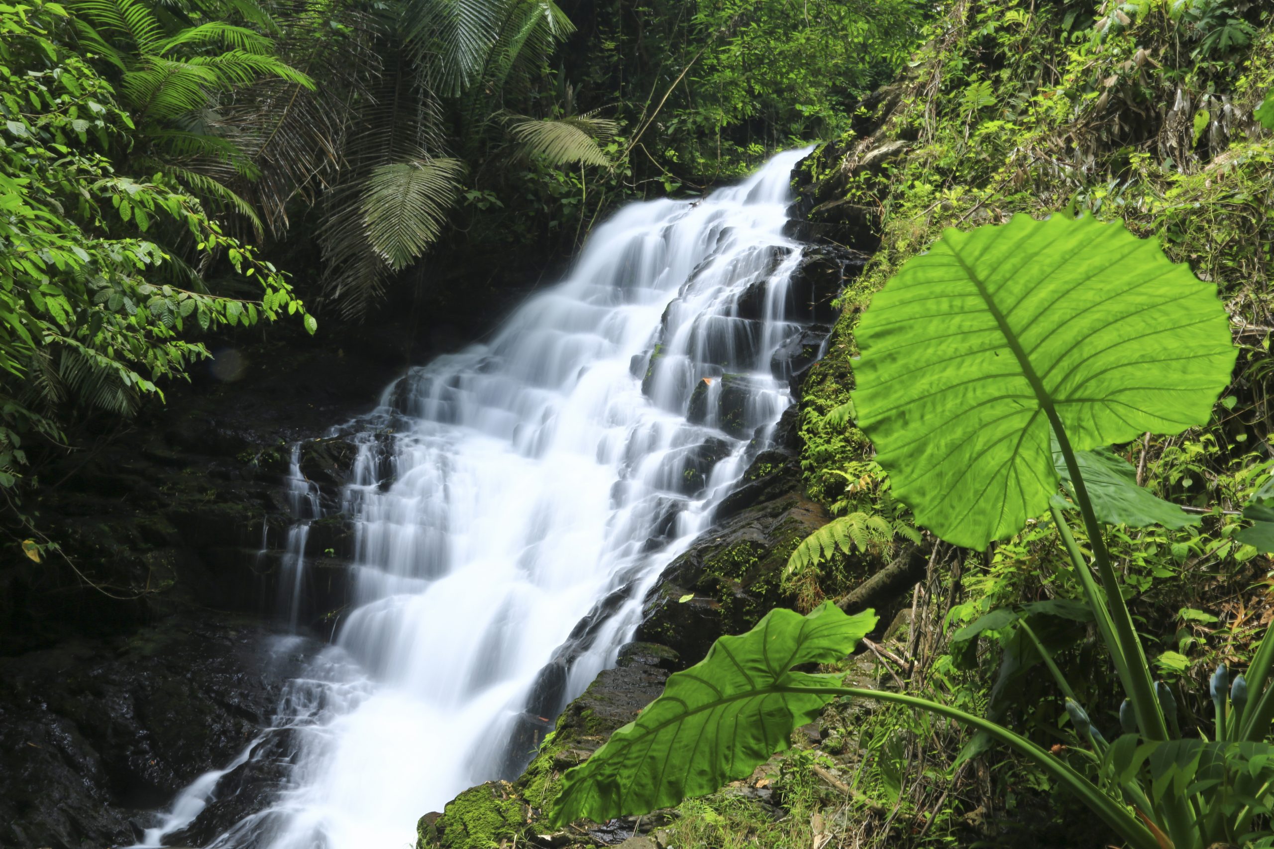
Khao Sip Ha Chan national park, situated in Ban Pong Ket, Tambon Khun Song with an area of 120 square kilometres, covers the mountainous area from north to south. The east area is parallel and extends to the Khao Soi Dao Wildlife Sanctuary. The highest peak is Khao Sip Ha Chan with the height of 802 metres above mean sea level. The forest covers dry evergreen forest and deciduous dipterocarp forest and is the habitat of wild animals; such as, monkey, gibbon, elephant, gaur, and banteng. Places of Interest in the National Park: Namtok Khao Sip Ha Chan or Namtok Khlong Sai is a 15-tiered medium-sized waterfall with water all-year round, located about 35 kilometres from Amphoe Kaeng Hang Maeo near Sa Kaeo province. Travel in the dry season is recommended. This route requires climbing up the mountain at higher levels and sometimes going around along the stream or climbing the waterfall’s terrain. Camping is allowed at the 6th tier and the 13th tier, which is the highest layer of 35 metres. A trek for nature study is available with a distance of 4.8 kilometres from the National Park’s Headquarters to the waterfall. Namtok Nam Pen is a medium-sized waterfall in the area of the Sip Ha Chan Mountains. The waterfall has more than 10 layers. The Park provides camping areas, but visitors have to bring their own tents. For more information, please contact the Department of National Parks, Wildlife and Plant Conservation, Tel. 0 2562 0760, www.dnp.go.th To get there: By public bus: from Bangkok, take a public bus to Amphoe Na Yai Am, then take a Song Thaeo at the market to get off at the National Park or charter a pick-up at the market of Amphoe Na Yai. The price is negotiable. By car: from Bangkok, take Highway No. 3 on the Bang Na-Trat route and change to Highway No. 344 on the Chon Buri-Ban Bueng route toward Amphoe Kaeng Hang Maeo for 240 kilometres. From Amphoe Kaeng Hang Maeo, continue to Tambon Khun Song for 10 kilometres, a total distance of approximately 250 kilometres. Alternatively, use Highway No. 3 and change to Highway No. 344 then go to the Wang Chan-Nong Chek Soi route toward Amphoe Kaeng Hang Maeo for 200 kilometres and from Amphoe Kaeng Hang Maeo to Tambon Khun Song for 10 kilometres. The total distance is approximately 210 kilometres.